Mapping Out The Future
St. Louis is positioned to become an international hub for the geospatial industry.
Dip a toe in. Engage. Learn.
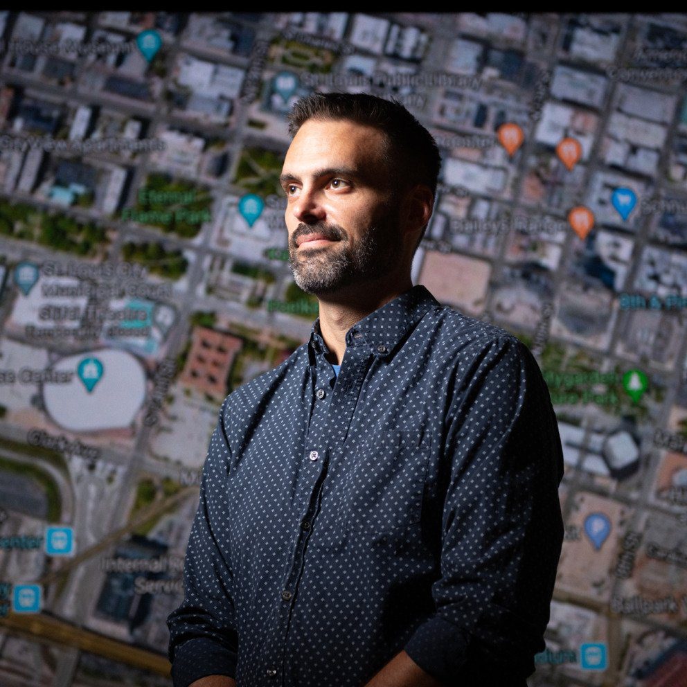
These are the things Andrew Dearing encourages people to do when it comes to geospatial tech in St. Louis. Dearing, who is president of Spatial STL Advisors and project lead of GeoFutures, wants residents to know there are groups, meetups, videos and much more to help them dive into one of the fastest-growing industries in the region.
“That’s the great thing about our industry, everybody’s excited and passionate about what we’re doing,” he said. “There’s no dumb question, and I encourage everybody to get engaged.”
(Not sure what geospatial is? Check out our interactive slideshow.)
Dearing’s advice comes as St. Louis gears up to become an international hub for geospatial innovation.
As project lead of GeoFutures, a strategic planning initiative created to bolster the region’s evolving geospatial sector, he organized the effort to publish the GeoFutures Strategic Roadmap in June of this year. The roadmap will be used as a guide to grow the geospatial industry in St. Louis.
“Part of that effort was actually working with the community,” Dearing said. “Helping work with and coordinate with a lot of different members that are working in the geospatial space and with civic leaders and with industry leaders and the government, on the recommendations and the roadmap and how we’re going to execute this.”
The GeoFutures Strategic Roadmap listed over 40 businesses in St. Louis that are considered key players in the geospatial space, including corporations like Boeing, Bayer and Enterprise Holdings. These companies are using geospatial technology to sustainably improve agriculture and to enhance and streamline supply chain logistics in transportation and other sectors.
The roadmap also cited research company MarketsandMarkets, which estimated the global geospatial market at $239.1 billion in 2019 and growing to $502.6 billion by 2024.
“St. Louis is strongly positioned to be the global geospatial hub in the next five to 10 years. We’ve built and grown the geospatial sector organically,” Dearing said.
The goal of making St. Louis a global geospatial hub may seem daunting, but the GeoFutures report cites St. Louis’ history in the past two decades of becoming a center of excellence for plant science as proof that St. Louis can grow into this role for the geospatial industry.
“We have the Danforth Plant Life Science Center, which is doing deep research and helping those startups. That never existed before — so their strategy was a build strategy,” Dearing said. He sees the success of plant science as paving the way for geospatial.
While St. Louis is currently a hub of geospatial activity, many will agree that the city’s future as a leading destination in the industry was solidified when the National Geospatial-Intelligence Agency decided to build its Next NGA West headquarters on a 97-acre site just north of Downtown St. Louis. The NGA is investing $1.7 billion to construct the state-of-the-art campus, with plans for it to be fully operational by 2025.
Currently, the NGA is headquartered in Springfield, Virginia, and has two major locations in St. Louis and Arnold, Missouri.
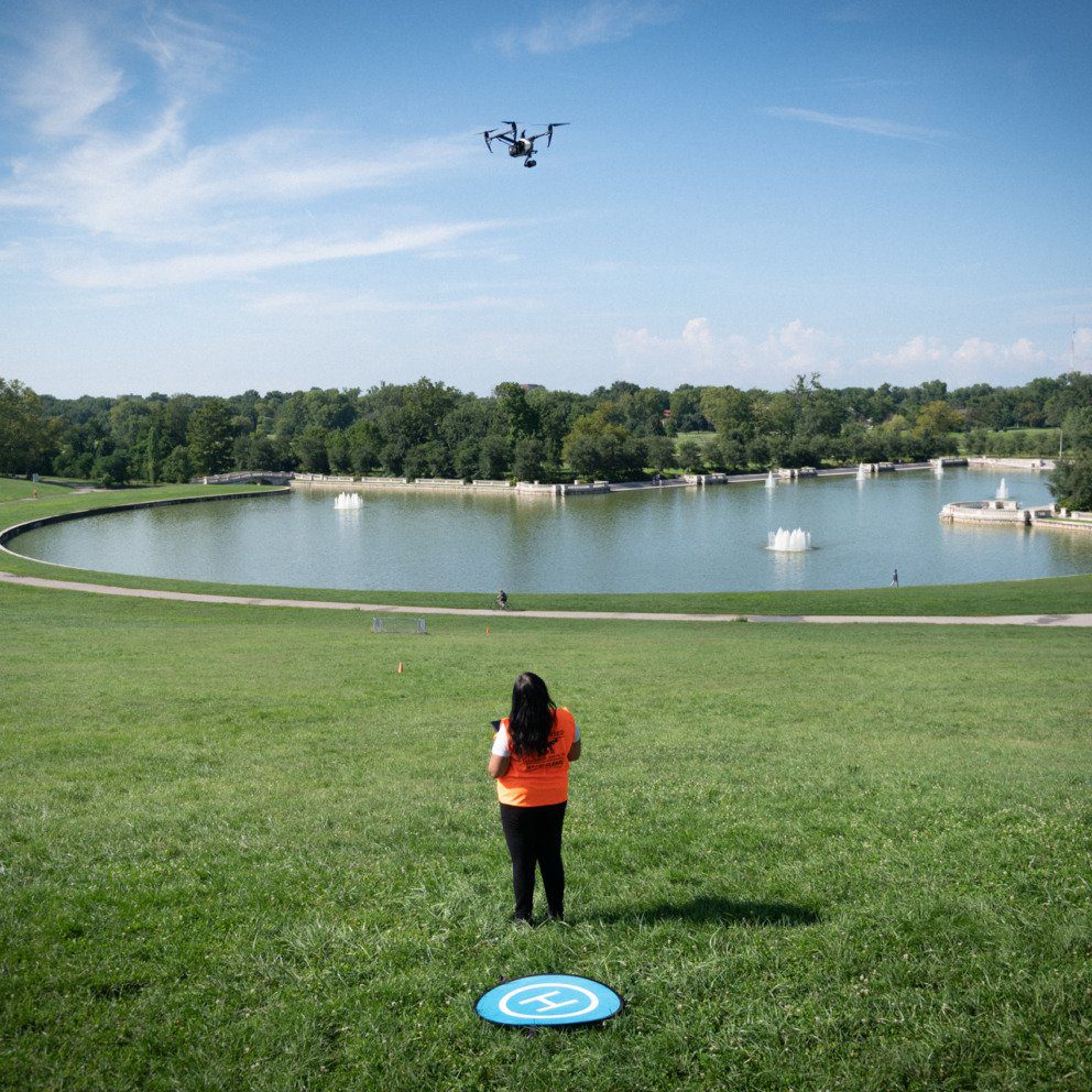
“St. Louis has a unique opportunity with the NGA, as well as the work that’s being taken on at the university level at Saint Louis University and Washington University with geospatial, to create an environment here that is the hotbed for all things GIS and geospatial related,” said Bronwyn Morgan, founder of drone services and data company XEO Air.
She says the concept of her company, using aerial data for industries outside of geospatial, is new – like so many businesses in the industry – and presents boundless opportunities.
“Mixing this geospatial data in with business intelligence and now artificial intelligence becomes a game changer,” she said. “So using that data to make faster decisions, it will become a part of everything, especially when we start getting into things like drone delivery and services — geospatial will become an even bigger player in the smart cities of the future.”
The GeoFutures roadmap listed four specific sectors in St. Louis where locational data and geospatial technologies are being used for a competitive advantage: national security; digital and precision agriculture; transportation and logistics; and health care delivery.
The newness of the technology demands St. Louis provide educational programs to train a geospatial workforce to fill the roles that this growing industry will create.
Dearing sees addressing the tech talent shortage in the region as a crucial step for the city’s success.
“Specifically here in St. Louis, we have to also do that with racial equity and inclusion in mind,” he said. “Especially where NGA is moving its campus into, there’s an existing neighborhood that’s there and we’ve got to help provide K-12 pathways, we’ve got to work with the community to help address some of those things.”
Morgan notes that those programs don’t have to be degree tracks, because talent of all levels is needed.
“Some of this work does not require a four year education or a master’s degree or Ph.D. — we want that, too — but some of this work is done by very smart folks who have 12, 18 months worth of experience to get these certificates and can come in making amazing money and then be trained for the rest,” Morgan said.
And while the NGA’s new headquarters and the GeoFutures plan are expected to have a significant economic impact and bring massive job growth to the area, One America Works found St. Louis’ geospatial industry is already responsible for 27,000 jobs and nearly $5 billion in economic impact within the region.
Dearing said the region has what it takes to secure the lead in the industry, pointing to the fact that St. Louis already has a substantial amount of venture capital for geospatial startups, industry financing from programs such as Arch Grants and innovation districts including Cortex and T-REX.
“We’ve got the right ingredients here in St. Louis, we’ve got folks that are extremely excited and passionate about geospatial,” Dearing said. “And we’ve got people here that are saying, ‘I don’t know what geospatial is, but I want to be a part of it.’”
This story is the fourth in our series on geospatial in St. Louis. Read the others here:
Join the Story
- Watch the previously recorded GeoFutures’ strategic roadmap launch event here.
- Check out HEC Media’s conversation with Kendrick Faison of Spatial GIS.